MetalsGrove Intensifies Gold Search in West Africa with Cutting-Edge Mapping Techniques
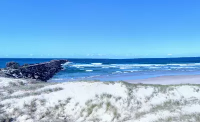
MetalsGrove Mining has initiated a comprehensive exploration program at its Zuénoula gold project in Côte d'Ivoire, West Africa, aiming to pinpoint high-priority drill targets through advanced surface analysis. The company is deploying an integrated approach that includes detailed regolith landform mapping, rock chip sampling, and high-resolution topographic imaging using LiDAR technology.
Strategic Exploration Campaign Underway
The new work, conducted by SEMS Exploration Côte d'Ivoire SARL, focuses on following up hotspots within the Zuénoula permit. This project is part of MetalsGrove's broader Central West gold project, which spans 1,315 square kilometres and includes three other ventures under the Gemica and Stellar joint venture permits. The initial phase involves a regolith mapping campaign designed to interpret surface materials and their impact on gold signals in an area with limited rock outcrops.
Advanced Technologies Drive Target Identification
In parallel, MetalsGrove plans to fly a drone-based LiDAR survey across 21 square kilometres of the prospective area. LiDAR, or light detection and ranging, uses laser pulses to create detailed 3D maps of the land surface, achieving up to 94 data points per square metre for high accuracy. This technology can reveal subtle features like faults, geological contacts, and signs of historical human activity, even in densely vegetated environments.

Lijun Yang, managing director and chief executive officer of MetalsGrove Mining, stated, "The commencement of detailed regolith mapping and high-resolution LiDAR surveying at Zuénoula represents an important step in advancing our exploration strategy across the Central West Gold Project. These programs will provide critical datasets to better understand regolith development, structural controls, and gold dispersion patterns."
Recent Discoveries and Regional Context
Last week, MetalsGrove announced that soil sampling from a district-scale survey identified a new gold target area, named the Fifty-Five Area, prompting follow-up sampling on a tighter grid. This adds to previously defined targets like the Central and South East Corner areas within Zuénoula, all awaiting results from enhanced sampling efforts.
Zuénoula is situated 160 kilometres south of Aurum Resources' Boundiali-Napié gold project, which holds 3.9 million ounces of gold. The region is renowned for its rich gold deposits, including the 3.8-million-ounce Abujar and 3.9-million-ounce Yaouré projects, all located within 100 kilometres of Zuénoula along the Birimian greenstone belt.
Future Prospects and Timeline
With field crews aiming to complete the survey work by the end of March, MetalsGrove is gathering practical, high-value data that could swiftly transform this promising gold corridor into a focused drilling plan. The integration of digital modelling from LiDAR and other datasets will aid in accurately positioning mine designs and understanding mineralisation controls in the area.