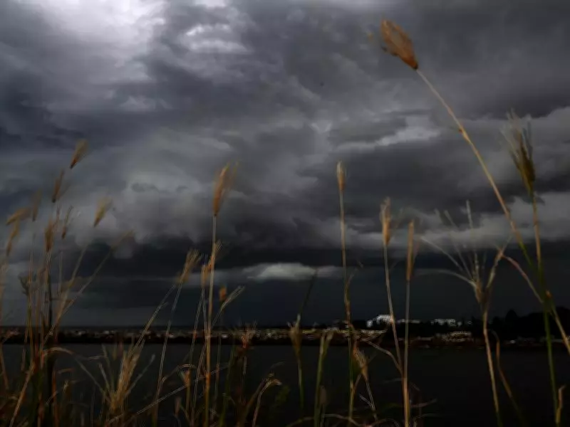
Cyclone Narelle Brings Uncertainty and Severe Weather to Perth
Western Australia's northwest coast is already experiencing dreary conditions as Tropical Cyclone Narelle has reformed at sea, setting the stage for a tumultuous week ahead. The tropical system was reclassified as a Category 1 cyclone on Wednesday and is expected to intensify to Category 3 by Thursday as it approaches the WA coastline.
Uncertain Path Puts Perth on High Alert
While current predictions suggest Cyclone Narelle may navigate around Perth this weekend, weather experts emphasize there is significant uncertainty about whether the city will escape its destructive path. Bureau of Meteorology meteorologist Helen Reid stated, "Perth is currently expected to be west of the storm, but there is still uncertainty about its path." If Narelle crosses the metropolitan area, it would mark the first cyclone to hit Perth in 36 years, following heavy rains from Cyclone Seroja in 2021.
Severe Weather Warnings Issued for Perth
A severe weather warning is already in effect across Perth, with damaging winds forecast to begin on Wednesday night between Gingin and Busselton. Bureau officials explained that a high-pressure system southwest of the state, combined with a trough off the west coast, will generate vigorous easterly winds over the Darling Scarp. These winds are anticipated to reach speeds of 55 to 65 km/h, with peak gusts of 90 km/h battering the Perth Hills overnight.

Ms. Reid warned, "With the strength of the winds, people should make preparations to ensure any loose items on their property are secured." While easterly winds are common in autumn, this week's cyclone-strength winds pose risks of property damage and hazardous road conditions.
Heavy Rainfall and Flash Flooding Risks
In addition to strong winds, heavy rainfall is forecast to batter Perth on Friday and Saturday, with up to 60 mm of rain expected each day. Although major flooding like that seen in the Northern Territory is unlikely, Ms. Reid cautioned that flash flooding remains a possibility in parts of the metropolitan region. "Some of the rainfall from Saturday's storms could fall quickly enough to cause flooding in some parts of Perth," she said.
The Bureau of Meteorology issued a flood watch warning on Wednesday, alerting residents that catchments such as the Swan River may experience level rises and land flooding from Thursday. The official warning advises, "Roads may be affected by flooding, so check road conditions before travelling."
Residents Urged to Stay Informed
As Cyclone Narelle continues to track closer to making landfall in WA, Ms. Reid urged Perth residents to regularly monitor weather websites for updates. "Please keep up to date, there are still a couple of days before Narelle is expected to hit and things can quickly change," she emphasized. The severe weather has already led to the postponement of events in Perth this weekend, highlighting the storm's potential impact.
Perth's weather forecast for the week includes temperatures ranging from 16°C to 28°C, with mostly sunny conditions on Wednesday giving way to possible showers from Thursday through Tuesday. Residents are advised to prepare for ongoing wild weather and stay vigilant as the situation evolves.