Severe Tropical Cyclone Maila Creeps Toward Queensland Coastline
Severe Tropical Cyclone Maila continues its slow, ominous approach toward the Queensland coast, with meteorological experts now forecasting a potential landfall as early as Monday. The super storm's precise crossing location remains uncertain as weather models present conflicting predictions, keeping communities on high alert.
Current Status and Movement Patterns
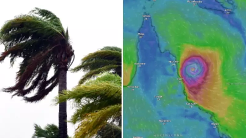
Currently positioned as a severe Category 4 system in the Solomon Sea between Papua New Guinea and the Solomon Islands, Maila boasts destructive wind gusts reaching up to 250 kilometers per hour. The cyclone has been downgraded from its peak Category 5 intensity recorded on Wednesday, but maintains significant destructive potential.
"It remains approximately 1,300 kilometers northeast of Queensland," explained senior meteorologist Jonathan How. "While movement was minimal overnight into Thursday, the system will begin tracking westward toward the Australian mainland throughout today."

How detailed that Maila will continue moving in a west to southwesterly direction through Friday, maintaining a sluggish pace of less than 10 kilometers per hour. This slow movement allows for continued monitoring but extends the period of uncertainty for coastal communities.
Projected Path and Intensity Changes
As Maila interacts with Papua New Guinea's landmass, meteorologists anticipate further downgrading to Category 3 intensity by Friday morning. The storm has already begun impacting western Solomon Islands and triggered cyclone warnings for Milne Bay Province in Papua New Guinea, including Woodlark, Sudet, Misima, Rossel Islands and Bougainville communities.
"Later on Saturday, Maila will enter the northern Coral Sea while remaining well offshore from Queensland and Australian islands," How noted. "The system's final approach toward far north Queensland is expected Sunday into Monday."
Current forecasts suggest Tropical Cyclone Maila will most likely cross the northern Queensland coast early next week, probably on Tuesday as a Category 2 system. The probable crossing zone appears increasingly focused between Cooktown and Lockhart River—alarmingly close to where Severe Tropical Cyclone Narelle made landfall just last month.
Potential Impacts and Regional Context
Communities within the projected path should prepare for damaging to destructive winds, heavy rainfall, and coastal erosion. However, How emphasized that "the exact location, timing and strength remain subject to numerous influencing factors, with the crossing still approximately five days away."
Forecast precision will improve as Maila nears the coastline, relying on refined computer models and observational data. Meanwhile, the South Pacific contends with additional cyclone activity as Severe Tropical Cyclone Vaianu—a Category 3 system that formed near Fiji—brings heavy rain and destructive winds while tracking through the region.
Vaianu is expected to move south later this week toward New Zealand, potentially bringing rain and storm activity to the North Island. The dual cyclone situation has created travel disruptions, with Fiji experiencing lockdowns as residents and travelers shelter from Vaianu's impacts.
Australian weather authorities continue monitoring both systems closely, urging Queensland coastal residents to stay informed through official Bureau of Meteorology updates as Cyclone Maila's trajectory becomes clearer in coming days.