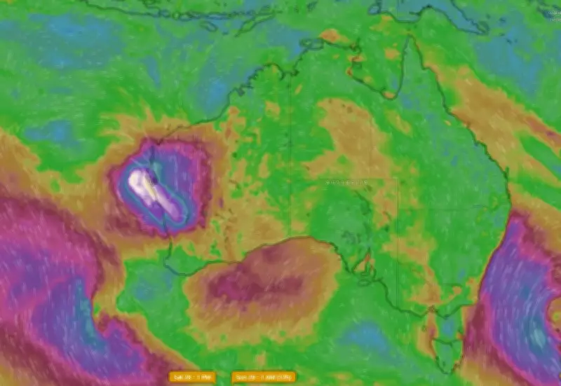
Cyclone Narelle Intensifies to Category 3, Category 4 Expected as It Approaches WA Coast
Severe tropical cyclone Narelle has been upgraded to a category 3 system on Wednesday evening and is anticipated to escalate to category 4 as it crosses the Western Australian coast. This development follows Narelle's initial downgrade to an ex-tropical cyclone, with the storm gathering significant strength as it traversed down the northern WA coastline.
Urgent Warnings Issued for Multiple Regions
The Bureau of Meteorology has issued a watch and act warning at 6.47pm for Barrow Island, Monte Bello islands, and the area from Roebourne to the east of Exmouth, indicating a potential threat to lives and homes. Emergency WA has advised residents to take immediate action and prepare to shelter from the cyclone.
Additionally, a warning has been extended to people in the region between Sandfire Roadhouse and Coral Bay, encompassing Port Hedland, Karratha, Onslow, Exmouth, and inland to Pannawonica. The zone from Coral Bay to Kalbarri, including Carnarvon and Denham, and inland to Gascoyne Junction and Murchison, has been designated as a cyclone watch area.

Expected Severe Impacts and Preparations
Destructive wind gusts of up to 260km/h are forecast across the warning area, accompanied by dangerous flooding and storm tides. The Bureau of Meteorology warns of severe impacts for several towns as Narelle approaches.
Residents are urged to implement their emergency plans immediately. Key preparation steps include:
- Putting your emergency plan into action or creating one via the Emergency WA website or app.
- Moving to evacuation centres if living in caravans, older homes, or poorly maintained properties.
- Securing loose items such as trampolines and outdoor furniture.
- Preparing an emergency kit with canned food, water for five to seven days, a first aid kit, medication, cash, and a battery-operated AM/FM radio.
- Moving vehicles under cover and fastening cyclone shutters or boarding up windows.
- Ensuring the safety of pets and animals and charging mobile phones in case of power outages.
Travellers, visitors, and tourists are strongly advised to leave the warning area. It is crucial to monitor the Emergency WA website for updates and know the cyclone warning levels and corresponding actions.
Cyclone Path and Future Projections
Narelle is currently moving in a southwest direction but is expected to pivot further south on Friday, passing near Exmouth and Onslow as a category 4 system. The cyclone is then projected to weaken as it moves south-southeast towards the Central West and South West Land Division.
Residents should remain vigilant, as strong winds and heavy rainfall may occur before the cyclone makes landfall. Staying indoors during deteriorating conditions is recommended for safety.