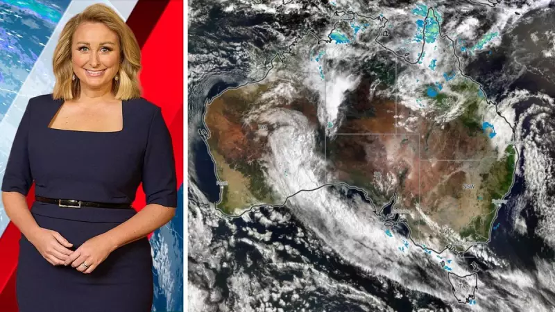
If you have been monitoring satellite imagery recently, you will have observed an extensive area of cloud and precipitation traversing the Kimberley region and the interior of Western Australia. This phenomenon represents the typical aftermath of a cyclone—a substantial mass of moisture that disperses across various parts of the nation, dictated by the prevailing atmospheric conditions.
Rainfall Bypasses Drought-Affected Southeast
For residents in southeastern Australia, where conditions have been persistently hot and arid—not merely for a day, but extending over weeks and occasionally months—this abundant rainfall would be exceptionally beneficial. Primarily, it would dissipate the accumulated heat. Additionally, it would revitalise the environment, aiding in the suppression of existing bushfires and mitigating the risk of new ignitions.
However, the current meteorological patterns are not favouring the southeast. The cloudband, rich with moisture, is tracking almost directly southward. It will pass over southeastern Western Australia before moving out to sea. Although the weather system curves slightly eastward, this deviation is insufficient to even reach Tasmania.

Prolonged Heatwave Intensifies
Consequently, the extensive heatwave persists. It commenced on the Saturday of the long weekend, and for those not situated near the coastline, relief remains elusive for the foreseeable future. This heatwave has not been characterised by intense winds, but its duration and peak temperatures have become significant points of discussion. New records are being set not only at individual, long-standing weather stations but also for state-wide maximum temperatures.
So, when is this heatwave expected to conclude? For much of inland southeastern Australia, the end is anticipated this weekend.
Weather Shift Brings Temperature Change and Rain
Instead of a weak trough influenced by adjacent high pressure, the forecast indicates that the high-pressure system will position itself southwest of Perth. This placement is crucial as it allows a more substantial weather system to traverse the southeast without obstruction, thereby enhancing its impact.
The primary effect will likely be a notable shift in temperature, effectively dispelling the heat from inland areas as well as coastal regions—at least extending up to northern New South Wales. Accompanying this change will be rainfall, though not uniformly distributed.
Rainfall Distribution and Future Focus
Regrettably, western New South Wales, western Victoria, and South Australia will miss out on this precipitation, which is once again forecast to fall predominantly in eastern areas. The moisture influx originates from the Pacific Ocean and is supplemented by ongoing rainfall in northern Queensland. By the time the low-pressure system interacts with this moisture, it is positioned too far east to benefit those western localities.
Thus, while the heatwave continues, its conclusion is now within sight. Attention may soon shift to an area of intense rainfall—encompassing rain, storms, and potential flooding—primarily affecting eastern Victoria, New South Wales, and Queensland.