Port Stephens Bushfire Scorches Over 200 Hectares, Crews Strengthen Containment Lines
Firefighters have taken advantage of milder overnight conditions to bolster containment lines at a significant bushfire in the Port Stephens area, which has already burned through more than 200 hectares of land. The blaze, located near Oyster Cove, sent smoke billowing toward Raymond Terrace and Medowie on Thursday afternoon, with local reports indicating ash and a strong smell of fire in the air.
Fire Threat Downgraded as Crews Work Overnight
The New South Wales Rural Fire Service issued a statement on Thursday night confirming that conditions on the fireground had eased, reducing the threat to properties. Residents in the vicinity of James Road and Coachwood Drive at Medowie, as well as those near the Moffats Swamp Nature Reserve, were initially advised to leave if not prepared with a bushfire survival plan. However, the warning level was later downgraded to monitor conditions overnight.
Firefighters, supported by heavy machinery, continued to work through the night to establish and strengthen containment lines. Those living on the eastern outskirts of Medowie, along Lemon Tree Passage Road and Oyster Cove, are urged to stay vigilant and keep updated on any changes in the situation.

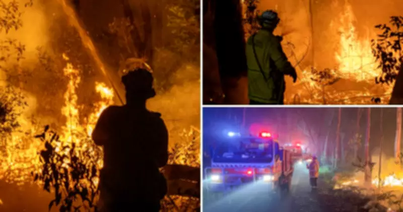
Multi-Agency Response and Statewide Fire Activity
The firefighting effort has involved a coordinated response from multiple agencies. Crews from the Thornton and Lower Hunter brigades have been on the scene assisting the RFS, alongside personnel from NSW National Parks and Wildlife and Airforce firefighters based at Williamtown. NSW Police and Ambulance services reported no injuries overnight, providing some relief amid the emergency.
The blaze was initially reported burning south around 1.20pm on Thursday, moving toward the Tilligerry State Conservation Area. Authorities had urged residents in the district to monitor conditions closely. The Hunter region was listed with a high fire danger rating on Thursday, with expectations that this would persist through the weekend.
In a related development, a total fire ban was declared in the neighbouring Northern Slopes region, covering council areas including Gunnedah, Gwydir, Inverell, Liverpool Plains, and Tamworth. Across the state, approximately 54 fires were burning on Thursday evening, highlighting a widespread bushfire threat. One notable fire on the Mid North Coast had consumed around 389 hectares of national parks bushland at Nerong, with NSW National Parks and Wildlife crews working to control it into the early evening.
Safety Advice for Residents
As the situation continues to develop, residents are advised to stay informed through official channels. For immediate updates and advice, the Hazards Near Me app or Fires Near Me website are recommended resources to monitor changing conditions and ensure safety.