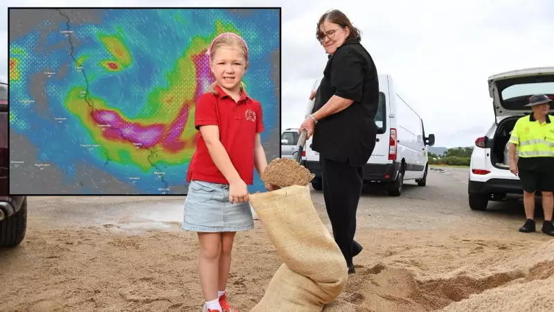
A tropical low brewing in the Coral Sea is rapidly gaining strength and is expected to develop into a tropical cyclone within the next 24 hours, posing a significant threat to North Queensland communities. The Bureau of Meteorology has issued a cyclone watch for coastal areas from Innisfail to Bowen, including Townsville and the Whitsunday Islands.
System Intensifies, Warnings Issued
The weather system, currently designated as a tropical low, is located approximately 800 kilometres east-northeast of Cairns. It is moving slowly in a southwesterly direction. The Bureau confirms the low is likely to develop into a tropical cyclone on Saturday, with the potential for it to be named Cyclone Kirrily if it reaches the required intensity.
Forecasters predict the system will continue to track towards the Queensland coast over the weekend. Damaging winds, heavy rainfall, and dangerous surf conditions are anticipated to impact the watch zone from late Sunday. The specific track and intensity as it approaches the coast remain uncertain, with models showing a range of possible scenarios.

Communities Urged to Prepare
Local disaster management groups across the region have been activated. Residents within the watch area are being urged to commence their cyclone preparations immediately. This includes:
- Securing loose outdoor items and clearing yards of potential projectiles.
- Reviewing and finalising household emergency plans and evacuation kits.
- Closely monitoring official updates from the Bureau of Meteorology and local authorities.
Queensland Fire and Emergency Services (QFES) has advised people to avoid unnecessary travel into the predicted impact area. The potential for flash flooding is high, with some coastal catchments likely to receive intense, torrential rain.
What Happens Next?
The Bureau of Meteorology will provide its next detailed update at 4:30 PM AEST. The situation is evolving rapidly, and the cyclone watch may be upgraded to a warning as the system consolidates. The key message for residents is to not focus on the exact forecast track, as cyclones are unpredictable and impacts can be felt well outside the predicted path.
This developing weather event serves as a critical reminder for all North Queenslanders to be cyclone-ready. The severe weather season is now in full swing, and this system underscores the importance of having a plan in place well before a threat emerges.