A dangerous and destructive storm system has wreaked havoc across southeast Queensland, bringing giant hailstones, widespread power outages and significant damage to properties from Brisbane to the Gold Coast.
Storm System Intensifies Across Region
The severe weather rolled into Brisbane early Monday afternoon, with the city disappearing under thick cloud cover as heavy rain and hail swept through the metropolitan area. The Bureau of Meteorology confirmed the storm produced hailstones measuring up to 10 centimetres at Ferny Hills and Alexandra Hills, while even larger 12-centimetre hail was reported at Gumdale.
Wind gusts reached dangerous speeds, with 100 km/h recorded at Maroochydore and 107 km/h at Brisbane Airport, adding to the destructive force of the weather system. The storm hit during the busy school pick-up period and afternoon commute, knocking out traffic lights and forcing schools to keep children indoors until conditions eased.

Widespread Damage and Power Outages
Energy provider Energex confirmed that more than 120,000 homes lost power between the Gold Coast and Sunshine Coast as the storm intensified, with Ipswich and Moreton Bay identified as the hardest-hit areas. The damage extended across multiple suburbs, with Mount Tamborine, Coombabah, Arundel and Helensvale all experiencing significant impacts.
Emergency services responded to numerous incidents, including a large tree that fell onto a unit block on Florabell Court at Wynnum West and several downed powerlines at Wellington Point. In a concerning development, downed lines sparked a grass fire at Walloon on the Warrego Highway.
Residents across Logan and Redlands areas reported extensive fallen trees, including major blockages on Mt Cotton Road at Carbrook and Boundary Street at Redland Bay. Logan Village recorded significant debris from the storm's impact.
Residents Describe Terrifying Hail Impact
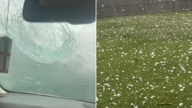
Residents in affected areas shared shocking images on social media showing massive hailstones, some larger than golf balls, with one playful dachshund even enjoying the unusual frozen toys that covered outdoor areas.
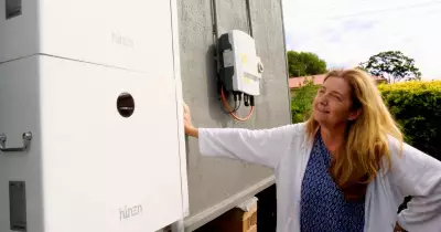
The storm system followed destructive weather south of Brisbane overnight, where cars were written off, solar panels shattered and roofs suffered extensive damage in suburbs including Loganholme, Bahrs Scrub, Waterford West and Beenleigh.
"There wasn't even rain beforehand. It just came out with hail," one shaken resident reported. "Pretty much golf ball sizes — if not softball sizes." Another added, "Every now and again, big ones were hitting the roof and you could hear them exploding," while a third commented grimly that "It's going to be an expensive bill for the insurance companies."
More Severe Weather Expected
The Bureau of Meteorology has warned that the severe weather threat continues, with the system tracking north toward the Sunshine Coast. BOM senior forecaster Felim Hanniffy stated that Monday was likely the peak storm day for the southeast, but stormy conditions are expected to continue through much of the week.
"We're looking at stormy conditions for much of the week," Hanniffy warned. "Along with the heat, it may be feeling very humid at times." The forecast indicates storms will push inland on Tuesday before spreading across much of eastern Queensland mid-week.
Large parts of Queensland remain under heatwave warnings, with temperatures expected to reach the low to mid-40s across western and central areas, and mid-30s to low-40s along the east coast. The BOM has advised residents to remain vigilant as the severe weather pattern continues to develop across the region.