The Bureau of Meteorology has officially declared an El Niño event as of June 16, after months of speculation. El Niño is a natural climate pattern characterized by warmer sea surface temperatures in the central and eastern Pacific Ocean and weakened trade winds. This shift alters the Walker Circulation, moving storm activity eastward and drawing moisture away from Australia. Historically, El Niño has been linked to some of the hottest and driest conditions on record in Australia.
Criteria for El Niño Declaration
El Niño events typically occur every three to seven years and last from six months to two years. They usually strengthen during winter and spring and weaken in autumn. The Bureau of Meteorology waited to declare El Niño until specific criteria were met, including at least three of the following:
- Sea surface temperatures in the central Pacific Ocean exceed 0.8°C above average.
- Trade winds across the Pacific have been weaker than average for the past four months.
- The Southern Oscillation Index (difference in atmospheric pressure between Tahiti and Darwin) is below -7.
- Most global seasonal forecasting models predict ocean temperatures will remain warm for at least three months.
Impacts on Australia
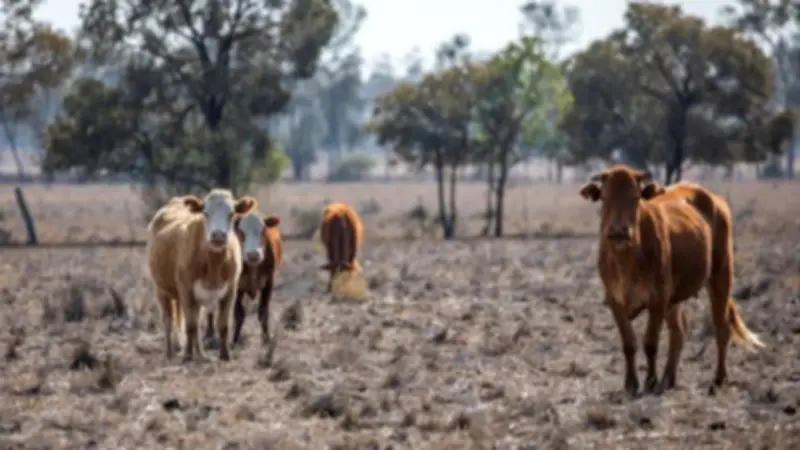
An El Niño declaration reflects current conditions, not a forecast. On average, El Niño brings warmer-than-normal maximum temperatures across Australia, especially in winter and spring, and drier conditions in eastern Australia. Western Australia is less affected due to its indirect connection to Pacific conditions. Northern Australia experiences fewer tropical cyclones and a delayed monsoon start. Interestingly, El Niño can lead to colder minimum temperatures and more frost due to reduced cloud cover, which normally traps heat at night. Globally, El Niño contributes to record-breaking temperatures, though human-caused greenhouse gas emissions remain the primary driver of global warming.

What About a 'Super El Niño'?
Some reports mention a potential 'super El Niño,' defined by sea surface temperatures about 2°C above normal. As of June 14, temperatures were 0.92°C above average, but models suggest they could exceed 2°C by late winter. However, a strong El Niño does not necessarily cause severe droughts or bushfires in Australia. For example, the weak 2002 El Niño led to widespread drought and bushfires, while the strong 2015 El Niño had varied rainfall impacts.
El Niño Is Not the Only Factor
Australian weather is influenced by multiple factors, including the Indian Ocean Dipole, shifts in the southern jet stream, and tropical storms. If waters off northwest Australia cool over winter, the year may be dry; if they warm, drought is less likely. The Bureau of Meteorology's long-range forecast integrates all these elements for accurate weather predictions.